
30 Jun
2023
Rio Tinto
Background Information
In the northeast of the Spanish province Huelva to the north of the small mining town of Nerva the Rio Tinto springs from the Sierra Padre Caro. From here the river is running about 100 km southwest and - together with the Rio Odiel - flows into the Atlantic Ocean close to the provincial capital Huelva.
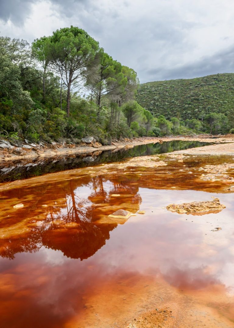
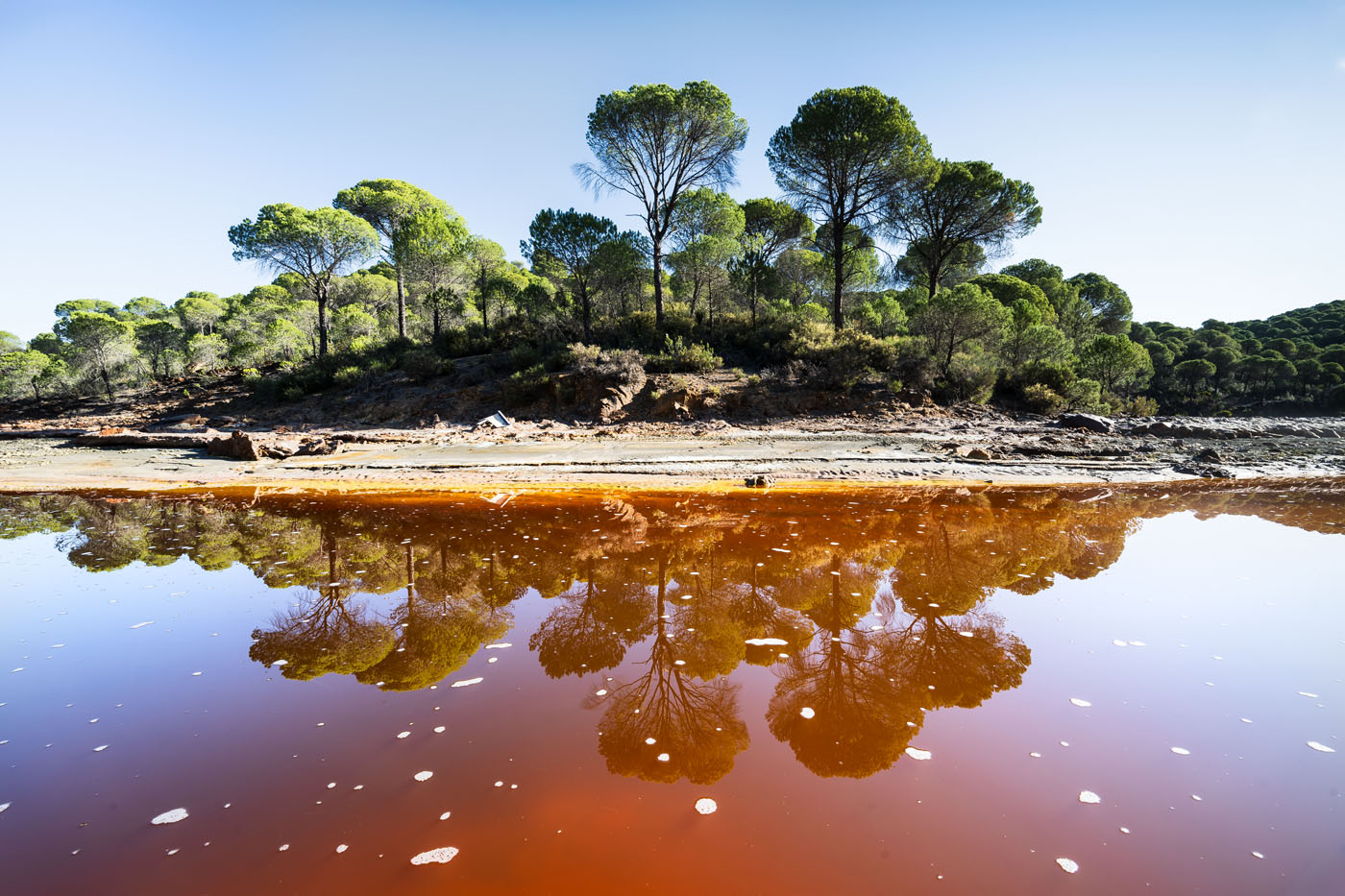
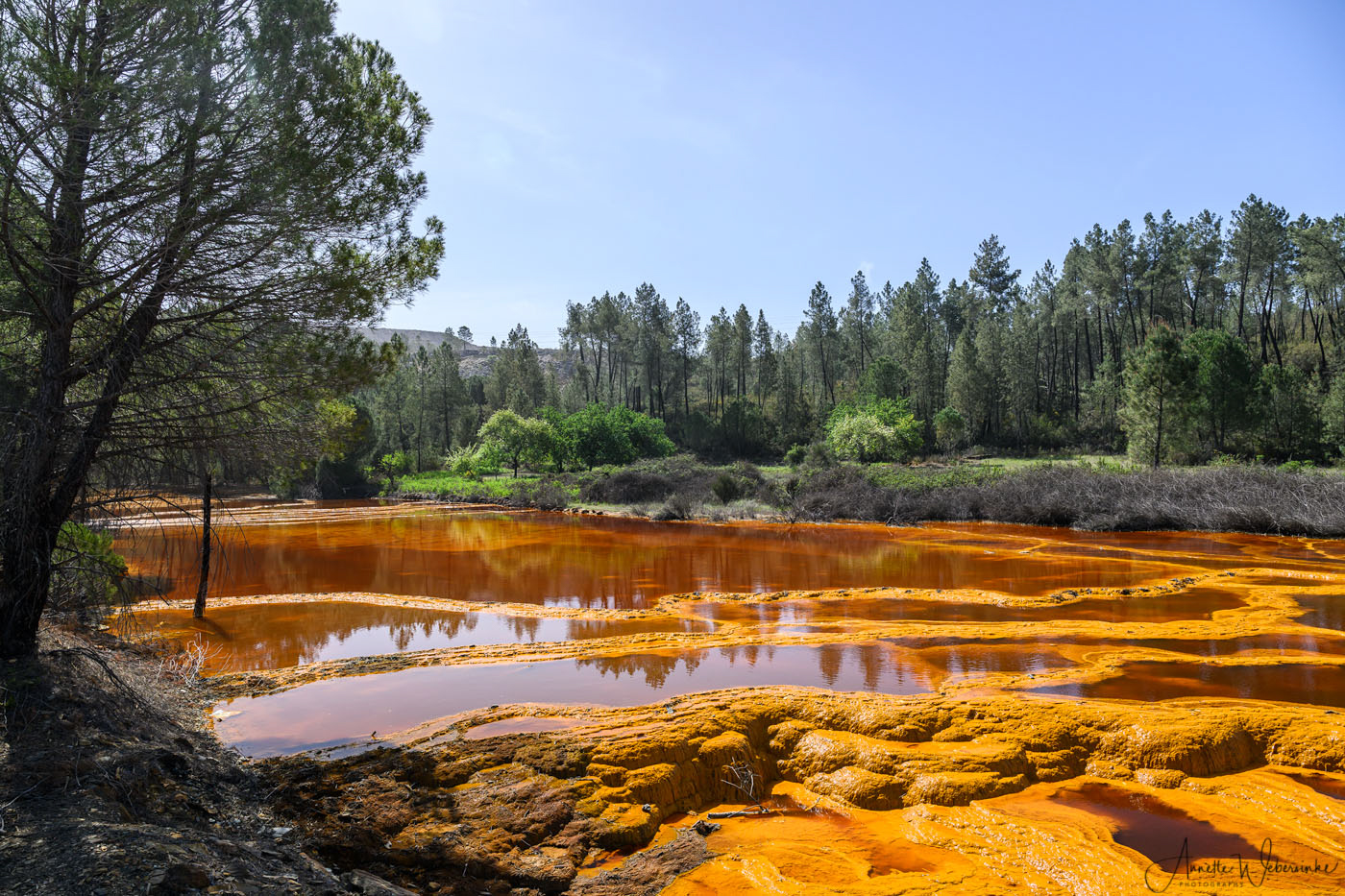
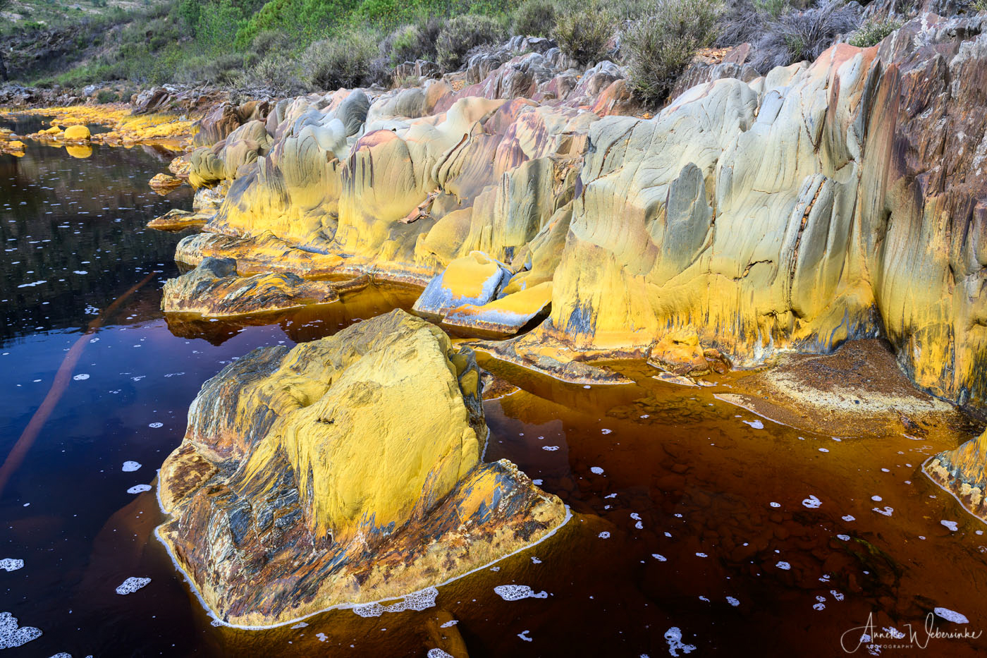
The river owes its name to its spectacular colour: tinto = red. Actually the Rio Tinto is exhibiting the whole range of red, pink and orange hues up to a dark violet. These incredible colors are being caused by the high concentration of iron salts and sulphates in the grounds of Minas de Riotinto which cause the rivers, streams and creeks emerge from the ground with this striking colour. As soon as the water gets in touch with oxygen it turns red.This is how some thousand years ago the Romans came across the iron deposits - they were struck by the conspicuous hue of the river. Several mines are situated along the course of the river. For thousands of years iron, copper, gold and silver has been exploited in this region, partly until today.
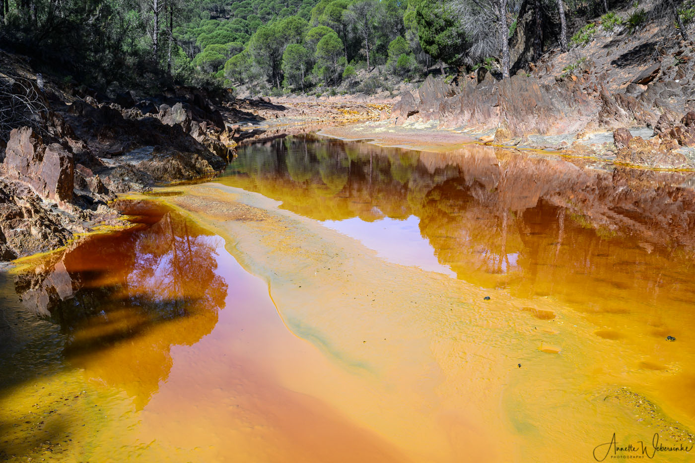
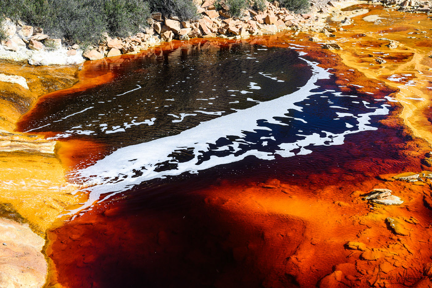
Rio Tinto is one of three acid rivers in this area: Rio Tinto and Rio Tintillo, the two red rivers and Rio Odiel which has a green and yellow colour. All three of them have a very low pH-factor of 2-3 which means that they are so acid that no other living being besides acid-loving bacteria are able to live in them. Besides they contain a high concentration of poisonous heavy metals.

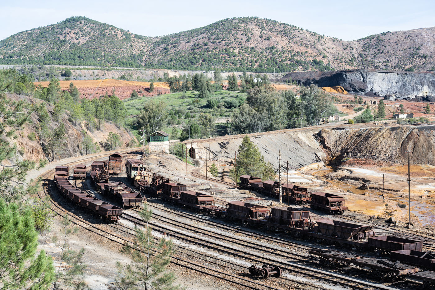
The upper reaches of Rio Tinto are characterized by the activities of Minas de Riotinto. Particularly while the mine was flourishing in the 19th century the whole landscape was being remodeled as a consequence of the opencast mining. A railway line was built from Minas de Riotinto to Huelva to transport the ore to the Harbour of Huelva, the small town of Minas de Riotinto was moved several times to make room for new pits and new mountains were being piled up with the waste material from the pits.
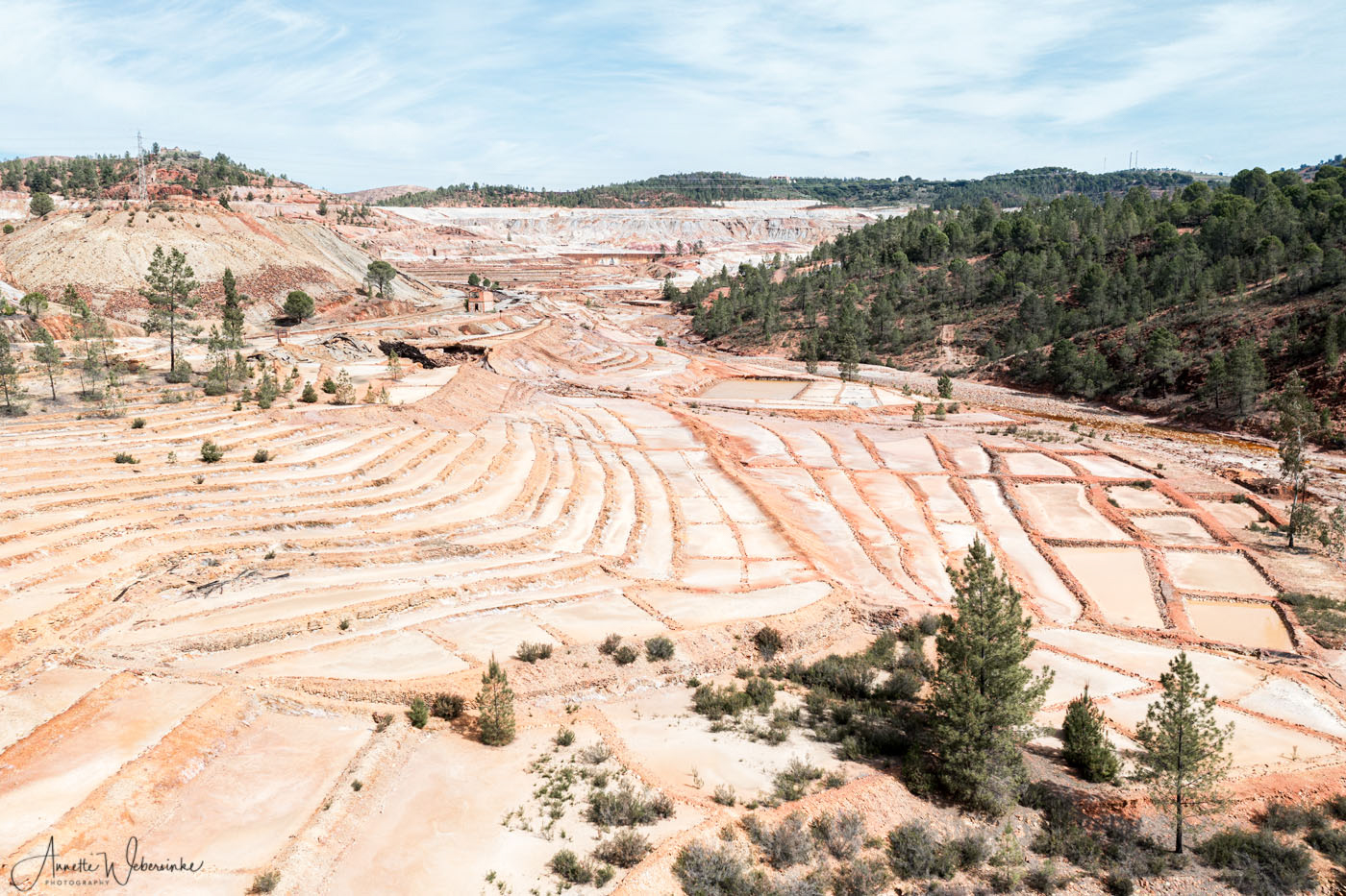
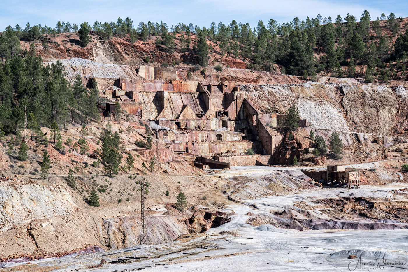
The mine was closed in 2001 and reopened in 2016 due to the rising prices for copper in particular.
So even today only parts of the terrain are accessible. There are still many old mining buildings in danger of collapsing, parts of the old railway line and loading stations and numerous rusty locomotives and wagons left to themselves. Time and again roads shown on Google maps end in front of a big steel door. Further south it’s easier to move along the river because a new hiking and biking trail has been built to enforce tourism in this underdeveloped area.

Datenschutzerklärung | Impressum | © Annette Webersinke
Wir benötigen Ihre Zustimmung zum Laden der Übersetzungen
Wir nutzen einen Drittanbieter-Service, um den Inhalt der Website zu übersetzen, der möglicherweise Daten über Ihre Aktivitäten sammelt. Bitte überprüfen Sie die Details in der Datenschutzerklärung und akzeptieren Sie den Dienst, um die Übersetzungen zu sehen.